Whitehorse, YT
| Whitehorse | ||
|---|---|---|
| City | ||
| City of Whitehorse | ||

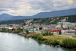
Downtown Whitehorse and Yukon River, June 2008
|
||
|
||
| Nickname(s): "The Wilderness City" | ||
| Motto: Our People, Our Strength | ||
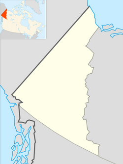
| Location of Whitehorse in Yukon | ||
| Coordinates: 60°43′N 135°03′W / 60.717°N 135.050°WCoordinates: 60°43′N 135°03′W / 60.717°N 135.050°W | ||
| Country |
|
|
| Territory |
|
|
| Established | 1898 | |
| Government | ||
| • City Mayor | Dan Curtis | |
| • Governing body | Whitehorse City Council | |
| • MPs | Larry Bagnell | |
| • MLAs |
Ted Adel Nils Clarke Jeanie Dendys Paolo Gallina Elizabeth Hanson Scott Kent Tracy McPhee Richard Mostyn Ranj Pillai Elaine Taylor Kate White |
|
| Area | ||
| • City | 416.54 km2 (160.83 sq mi) | |
| • Metro | 8,488.91 km2 (3,277.59 sq mi) | |
| Elevation | 670–1,702 m (2,200–5,584 ft) | |
| Population (2011) | ||
| • City | 23,276 | |
| • Density | 55.9/km2 (145/sq mi) | |
| Demonym(s) | Whitehorser | |
| Time zone | Pacific (PST) (UTC-8) | |
| • Summer (DST) | PDT (UTC-7) | |
| Area code(s) | 867 | |
| NTS Map | 105D11 | |
| GNBC Code | KABPC | |
| Website | www.city.whitehorse.yk.ca | |
Whitehorse (total area population 27,889 as of 2013) is the capital, largest, and only city of Yukon and the largest city in northern Canada. It was incorporated in 1950 and is located at kilometre 1426 on the Alaska Highway in southern Yukon. Whitehorse's downtown and Riverdale areas occupy both shores of the Yukon River, which originates in British Columbia and meets the Bering Sea in Alaska. The city was named after the White Horse Rapids for their resemblance to the mane of a white horse, near Miles Canyon, before the river was dammed.
Because of the city's location in the Whitehorse valley, the climate is milder than comparable northern communities such as Yellowknife. At this latitude winter days are short and summer days have up to about 19 hours of daylight. Whitehorse, as reported by Guinness World Records, is the city with the least air pollution in the world.
Archeological research south of the downtown area, at a location known as Canyon City, has revealed evidence of use by First Nations for several thousand years. The surrounding area had seasonal fish camps and Frederick Schwatka, in 1883, observed the presence of a portage trail used to bypass Miles Canyon. Before the Gold Rush, several different tribes passed through the area seasonally and their territories overlapped.
The discovery of gold in the Klondike in August, 1896, by Skookum Jim, Tagish Charlie and George Washington Carmack set off a major change in the historical patterns of the region. Early prospectors used the Chilkoot Pass, but by July 1897, crowds of neophyte stampeders had arrived via steamship and were camping at "White Horse". By June 1898, there was a bottleneck of stampeders at Canyon City, many boats had been lost to the rapids as well as five people. Samuel Steele of the North-West Mounted Police said: "why more casualties have not occurred is a mystery to me."
...
Wikipedia


