Willard-Hay, Minneapolis
| Willard-Hay | |
|---|---|
| Neighborhood | |
| Nickname(s): Willard-Homewood | |
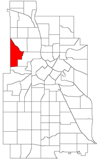
 Location of Willard-Hay within the U.S. city of Minneapolis |
|
| Country | United States |
| State | Minnesota |
| County | Hennepin |
| City | Minneapolis |
| Community | Near North |
| Area | |
| • Total | 1.068 sq mi (2.77 km2) |
| Population (2010) | |
| • Total | 8,611 |
| • Density | 8,100/sq mi (3,100/km2) |
| Time zone | CST (UTC-6) |
| • Summer (DST) | CDT (UTC-5) |
| ZIP code | 55411 |
| Area code(s) | 612 |
Willard-Hay is a neighborhood within the larger Near North community on the north side of Minneapolis. The boundaries are roughly Olson Highway on the south, Penn Avenue on the east, (though a small portion of the neighborhood is northeast of Penn and Plymouth) Broadway Avenue on the northeast and Theodore Wirth Park on the west. The neighborhood is often known as Willard-Homewood by residents; the portion south of Plymouth is Homewood. Coordinates: 44°59′47″N 93°18′40″W / 44.9964°N 93.3112°W
...
Wikipedia
