Witwatersrand
| Witwatersrand | |
|---|---|

Waterfall in the Walter Sisulu National Botanical Garden, formerly the Witwatersrand National Botanical Gardens. Waterfalls like this, cascading over a 56-kilometre-long (35 mi) quartzite ridge in Gauteng gave rise to the name “Witwatersrand”, which means “white water ridge” in Afrikaans.
|
|
| Highest point | |
| Elevation | 1,913 m (6,276 ft) |
| Coordinates | 26°12′13″S 28°2′34″E / 26.20361°S 28.04278°ECoordinates: 26°12′13″S 28°2′34″E / 26.20361°S 28.04278°E |
| Dimensions | |
| Length | 56 km (35 mi) ESE/WNW |
| Width | 10 km (6.2 mi) NNE/SSW |
| Geography | |
| Country | South Africa |
| Provinces | North West, Gauteng and Mpumalanga |
| Geology | |
| Orogeny | Vredefort meteor impact crater |
| Age of rock | Archaen |
| Type of rock | Quartzites, conglomerates, banded ironstones, tillites and shales |
| Climbing | |
| Easiest route | From Gauteng or Pretoria |
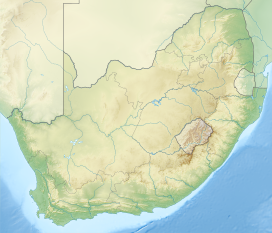
The Witwatersrand aka The Reef, is a 56-kilometre-long north-facing scarp in the Gauteng Province of South Africa. It consists of a hard, erosion-resistant quartzite sedimentary rock, over which several north-flowing rivers form waterfalls, which account for the name “Witwatersrand”, meaning the “ridge of white waters” in Afrikaans. This east–west-running scarp can be traced with only one short gap from Bedfordview (about 10 km west of O.R. Tambo International Airport) in the east, through Johannesburg and Roodepoort, to Krugersdorp in the west (see the diagram bottom-left below).
The scarp forms the northern edge of a 7- to 10-kilometre-wide plateau (or ridge) which rises about 200 m above the surrounding plains of the Highveld. The entire plateau-like structure is also often called the “Witwatersrand”. The plateau’s elevation above sea-level is between 1700–1800 m.
The Witwatersrand plateau forms a continental divide with the run-off to the north draining into the Indian Ocean via the Crocodile and Limpopo Rivers, while the run-off to the south drains via the Vaal into the Orange River and ultimately into the Atlantic Ocean.
The Witwatersrand lies within the province of Gauteng, formerly called the “PWV”, an abbreviation for Pretoria, "Witwatersrand" and Vereeniging. When used in this latter context, the term Witwatersrand refers to the entire Greater Johannesburg Metropolitan Area. This conurbation is oblong in shape and runs from Springs in the east to Randfontein and Carletonville in the west, as well as Soweto to the south. This area is also often colloquially referred to as “the Rand” or “Wits”.
...
Wikipedia

