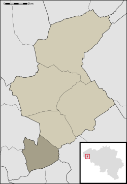
Zandvoorde (Zonnebeke)
| Zandvoorde | |
|---|---|
| Deelgemeente | |
 |
|
| Coordinates: 50°48′46″N 2°58′52″E / 50.81278°N 2.98111°ECoordinates: 50°48′46″N 2°58′52″E / 50.81278°N 2.98111°E | |
| Country | Belgium |
| Province |
|
| Municipality | Zonnebeke |
| Area | |
| • Total | 6.68 km2 (2.58 sq mi) |
| Population (1999) | |
| • Total | 474 |
| Source: NIS | |
| Postal code | 8980 |
Zandvoorde is a village in the Belgian province of West Flanders and a part (deelgemeente) of the municipality of Zonnebeke. Zandvoorde is a rural village, in the rolling landscape of the southern part of the province.
Old listings of the place date back to 1102, as Sanfort. "Sant" refers to sand (in modern Dutch: zand), "fort" refers to Ford (in modern Dutch: voorde), a shallow crossing in a watercourse.
The village was completely destroyed during World War I.
...
Wikipedia
