Kani, Gifu
|
Kani 可児市 |
||
|---|---|---|
| City | ||
|
||
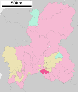
 Location of Kani in Gifu Prefecture |
||
| Location in Japan | ||
| Coordinates: 35°26′N 137°4′E / 35.433°N 137.067°ECoordinates: 35°26′N 137°4′E / 35.433°N 137.067°E | ||
| Country | Japan | |
| Region | Chūbu | |
| Prefecture | Gifu Prefecture | |
| Government | ||
| • Mayor | Shigeki Tomida | |
| Area | ||
| • Total | 87.60 km2 (33.82 sq mi) | |
| Population (July 2011) | ||
| • Total | 97,435 | |
| • Density | 1,100/km2 (2,900/sq mi) | |
| Symbols | ||
| • Tree | Japanese Black Pine | |
| • Flower | Satsuki azalea and rose | |
| Time zone | Japan Standard Time (UTC+9) | |
| City hall address | Hiromi 1-1, Kani-shi, Gifu-ken 509-0292 |
|
| Website | www |
|
Kani (可児市 Kani-shi?) is a city located in Gifu Prefecture, Japan.
As of July 2011, the city has an estimated population of 97,435 and a population density of 1,100 persons per km². The total area is 87.60 km².
The city was founded on April 1, 1982 when the town of Kani (可児町 Kani-chō?) gained city status. The town of Kani was formed in 1955 by a merger of 7 towns and villages in the western part of Kani District.
On May 1, 2005, the town of Kaneyama (also from Kani District) was merged into Kani.
International schools:
...
Wikipedia


