Arvert
| Arvert | |
|---|---|
| Commune | |

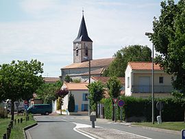
Saint Stephen church (17th century)
|
|
| Coordinates: 45°44′30″N 1°07′36″W / 45.7416°N 1.1266°WCoordinates: 45°44′30″N 1°07′36″W / 45.7416°N 1.1266°W | |
| Country | France |
| Region | Nouvelle-Aquitaine |
| Department | Charente-Maritime |
| Arrondissement | Rochefort |
| Canton | La Tremblade |
| Intercommunality | Royan Atlantique |
| Government | |
| • Mayor (2008–2020) | Michel Priouzeau |
| Area1 | 26.22 km2 (10.12 sq mi) |
| Population (2010)2 | 3,117 |
| • Density | 120/km2 (310/sq mi) |
| Time zone | CET (UTC+1) |
| • Summer (DST) | CEST (UTC+2) |
| INSEE/Postal code | 17021 /17530 |
| Elevation | 0–25 m (0–82 ft) (avg. 23 m or 75 ft) |
|
1 French Land Register data, which excludes lakes, ponds, glaciers > 1 km² (0.386 sq mi or 247 acres) and river estuaries. 2Population without double counting: residents of multiple communes (e.g., students and military personnel) only counted once. |
|
1 French Land Register data, which excludes lakes, ponds, glaciers > 1 km² (0.386 sq mi or 247 acres) and river estuaries.
Arvert is a French commune in the Charente-Maritime department and Nouvelle-Aquitaine region of south-western France.
The inhabitants of the commune are known as Alvertons or Alvertonnes.
Arvert is located some 14 km north-west of Royan and 8 km south of Marennes in the heart of the Peninsula of Arvert and the Royannnais Natural Region in the continental section of the Côte de Beauté and near the famous Marennes-Oléron Oyster basin between the Seudre, Gironde, and the Atlantic Ocean. There are two oyster ports in the commune: Coux and Grève à Duret.
The commune is the centre of a conurbation comprising La Tremblade (the main urban centre), Étaules, and Chaillevette and could be considered part of the outlying "suburbs" of Royan which is the main urban centre and economic hub of the area. Administratively it is part of the Canton of La Tremblade and the Arrondissement of Rochefort.
Access to the commune is by the D14 main road running north-west to south-east connecting La Tremblade to Saujon and passing north-west of the town. Access to the town is by the D14E1 road from La Tremblade through the town to Étaules. The D141 also connects the town to the D14 and continues south-west to Les Mathes. The D25 starts in the commune and bypasses La Tremblade to the north and continues to Ronce-les-Bains. The D268 branches of the D25 in the commune and goes west to the beaches on the west coast.
...
Wikipedia


