Ayherre
| Ayherre | ||
|---|---|---|
| Commune | ||

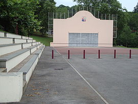
The Pelota Court
|
||
|
||
| Coordinates: 43°23′35″N 1°15′11″W / 43.3931°N 1.2531°WCoordinates: 43°23′35″N 1°15′11″W / 43.3931°N 1.2531°W | ||
| Country | France | |
| Region | Nouvelle-Aquitaine | |
| Department | Pyrénées-Atlantiques | |
| Arrondissement | Bayonne | |
| Canton | Pays de Bidache, Amikuze et Ostibarre | |
| Intercommunality | CA Pays Basque | |
| Government | ||
| • Mayor (2014–2020) | Arnaud Gastambide | |
| Area1 | 27.65 km2 (10.68 sq mi) | |
| Population (2010)2 | 987 | |
| • Density | 36/km2 (92/sq mi) | |
| Time zone | CET (UTC+1) | |
| • Summer (DST) | CEST (UTC+2) | |
| INSEE/Postal code | 64086 /64240 | |
| Elevation | 20–465 m (66–1,526 ft) (avg. 86 m or 282 ft) |
|
|
1 French Land Register data, which excludes lakes, ponds, glaciers > 1 km² (0.386 sq mi or 247 acres) and river estuaries. 2Population without double counting: residents of multiple communes (e.g., students and military personnel) only counted once. |
||
1 French Land Register data, which excludes lakes, ponds, glaciers > 1 km² (0.386 sq mi or 247 acres) and river estuaries.
Ayherre (Basque: Aiherre) is a commune in the Pyrénées-Atlantiques department in the Nouvelle-Aquitaine region of south-western France.
The inhabitants of the commune are known as Aihertars.
Ayherre is located in the Arberoue Valley in the former province of Lower Navarre some 23 km east by south-east of Bayonne and immediately east of Hasparren. Access to the commune is by the D10 road from Hasparren which passes through the west of the commune and continues north to La Bastide-Clairence. The D251 branches east off the D10 in the commune and goes to the village then continues east to Isturits. The D314 goes south-west from the village to Bonloc. The D14 from Bonloc to Saint-Esteben passes through the south of the commune. The commune is mainly farmland with scattered forests.
The commune is located in the drainage basin of the Adour with a dense network of streams covering the commune, mostly flowing north-westwards, and including the Joyeuse, which forms part of the western border of the commune. The Arbéroue rises in the south of the commune and flows north gathering many tributaries before joining the Lihoury to the north.
The commune name in basque is Aiherra. According to Jean-Baptiste Orpustan, the name comes from the basque ailherr ("incline"), giving the meaning "place on a slope".
The following table details the origins of the commune name and other names in the commune.
Sources:
Origins:
...
Wikipedia


