Lüen
| Lüen | ||
|---|---|---|
| Former municipality of Switzerland | ||

Lüen village
|
||
|
||
| Coordinates: 46°50′N 9°37′E / 46.833°N 9.617°ECoordinates: 46°50′N 9°37′E / 46.833°N 9.617°E | ||
| Country | Switzerland | |
| Canton | Graubünden | |
| District | Plessur | |
| Area | ||
| • Total | 3.46 km2 (1.34 sq mi) | |
| Elevation | 990 m (3,250 ft) | |
| Population (2010) | ||
| • Total | 84 | |
| • Density | 24/km2 (63/sq mi) | |
| Postal code | 7027 | |
| SFOS number | 3925 | |
| Surrounded by | Castiel, Praden, St. Peter-Pagig, Tschiertschen | |
| Website |
www SFSO statistics |
|
Lüen is a former municipality in the district of Plessur in the canton of Graubünden in Switzerland. On 1 January 2013 the former municipalities of Lüen, Calfreisen, Castiel, Langwies, Molinis, Peist and St. Peter-Pagig merged into the municipality of Arosa.
Lüen is first mentioned in 1084 as Leune.
Before the merger, Lüen had a total area of 3.5 km2 (1.4 sq mi). Of this area, 37% is used for agricultural purposes, while 52.3% is forested. Of the rest of the land, 1.4% is settled (buildings or roads) and the remainder (9.2%) is non-productive (rivers, glaciers or mountains).
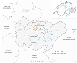
The former municipality is located in the Schanfigg sub-district of the Plessur district. It consists of the haufendorf village (an irregular, unplanned and quite closely packed village, built around a central square) of Lüen on the north face of the mid-Schanfigg.
In Lüen is the Lüen-Castiel railway station, on the Chur-Arosa railway line, which also serves Castiel.
Lüen had a population (as of 2010) of 84. As of 2008[update], 10.6% of the population was made up of foreign nationals. Over the last 10 years the population has decreased at a rate of -15.6%. Most of the population (as of 2000[update]) speaks German (91.9%), with English being second most common ( 4.1%) and Dutch being third ( 2.7%).
...
Wikipedia


