Lorain, Ohio
| Lorain, Ohio | ||||||
|---|---|---|---|---|---|---|
| City | ||||||
| City of Lorain | ||||||
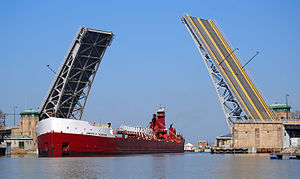
From top left: Lorain central business district; Lorain Palace Theater; the Lorain lighthouse; Charles Berry Bridge in the Lorain Harbor.
|
||||||
|
||||||
| Nickname(s): International City, Steel City | ||||||
 Location within the state of Ohio |
||||||
 Location of Lorain in Lorain County |
||||||
| Coordinates: 41°26′54″N 82°10′8″W / 41.44833°N 82.16889°WCoordinates: 41°26′54″N 82°10′8″W / 41.44833°N 82.16889°W | ||||||
| Country | United States of America | |||||
| State | Ohio | |||||
| County | Lorain | |||||
| Founded | 1807 | |||||
| Incorporated | February, 1817 | |||||
| Incorporated | July 16, 1834 (township) | |||||
| Government | ||||||
| • Type | Mayor–council | |||||
| • Mayor | Chase M. Ritenauer (D) | |||||
| • City Council |
Members
|
|||||
| Area | ||||||
| • Total | 24.14 sq mi (62.52 km2) | |||||
| • Land | 23.67 sq mi (61.31 km2) | |||||
| • Water | 0.47 sq mi (1.22 km2) | |||||
| Elevation | 610 ft (186 m) | |||||
| Population (2010) | ||||||
| • Total | 64,097 | |||||
| • Estimate (2015) | 63,647 | |||||
| • Density | 2,707.9/sq mi (1,045.5/km2) | |||||
| Time zone | EST (UTC-5) | |||||
| • Summer (DST) | EDT (UTC-4) | |||||
| Zip code(s) | 44052-44053-44054-44055 | |||||
| Area code(s) | 440 | |||||
| FIPS code | 39-44856 | |||||
| GNIS feature ID | 1077529 | |||||
| Website | http://www.cityoflorain.org | |||||
Lorain (pronounced /ləˈreɪn/) is a city in Lorain County, Ohio, United States. The municipality is located in northeastern Ohio on Lake Erie, at the mouth of the Black River, approximately 30 miles west of Cleveland. As of the 2010 census, the city had a total population of 64,097, making it Ohio's tenth largest city and the largest in Lorain County by population. Lorain is part of the Cleveland-Elyria Metropolitan Statistical Area, more commonly known as Greater Cleveland.
The city is notable for its deindustrialized economy, formerly being home to the American Ship Building Company Lorain Yard, Ford Motor Company Lorain Assembly Plant, and United States Steel Corporation's sprawling steel mill on the city's south side. The city faces many similar issues to other Rust Belt cities, including population decline and urban decay. Poverty in the city is above the national average at 27%, lower than Cleveland's 36.2% but higher than neighboring Elyria's 22.2%
Lorain is located in the former Western Reserve and was occupied by Native Americans until the consummation of the Treaty of Fort Industry in 1805. The treaty, between the U.S. government and the Wyandot, Ottawa, Chippewa, Munsee, Delaware, Shawnee, and, Pottawattamie, seceded the land west of the Cuyahoga River to the Connecticut Western Reserve. In notes from surveyor Abraham Tappan, land west of the Cuyahoga River was entirely void of permanent settlement from any people, meaning that all aboriginal people evacuated all 3,336,000 acres of land by the time Tappan arrived near the Black River in 1807. The first permanent settlement in present-day Lorain was founded in 1807 by Azariah Beebe and established as a trading post for trading goods with Native Americans. James Reid, one of the original settlers of Black River township, built a large house near the bluffs overlooking the Black River in 1812 to be used as a dwelling and tavern. In the following years, a post office for "Mouth of Black River," which also held the office for the Justice of the Peace.
...
Wikipedia


