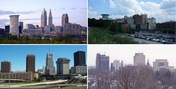
Northeast Ohio
| Northeast Ohio | |
|---|---|

|
|
 Map of counties in Northeast Ohio |
|
| Coordinates: 41°N 81°W / 41°N 81°WCoordinates: 41°N 81°W / 41°N 81°W | |
| Country | United States |
| State | Ohio |
| Largest city | Cleveland |
| Other cities | |
| Area | |
| • Land | 8,520.29 sq mi (22,067.4 km2) |
| • Water | 3,104.2 sq mi (8,040 km2) |
| Population (2010) | |
| • Total | 4,335,920 |
| • Density | 508.89/sq mi (196.48/km2) |
| Time zone | ET (UTC-5) |
| • Summer (DST) | EDT (UTC-4) |
Northeast Ohio refers to the northeastern region of the U.S. state of Ohio. The region contains six Metropolitan Statistical Areas: Cleveland–Elyria; Akron; Canton–Massillon; Youngstown–Warren–Boardman; Mansfield, and Sandusky, along with six Micropolitan Statistical Areas: Ashland, Ashtabula, New Philadelphia–Dover, Norwalk, Salem, and Wooster. Most of the region, with the exception of the Youngstown–Warren–Boardman and Mansfield metropolitan areas, is also part of the Cleveland–Akron–Canton Combined Statistical Area and media market, while Mahoning, Trumbull, and Columbiana counties form part of the Youngstown–Warren CSA and media market with Mercer County, Pennsylvania. Northeast Ohio also includes most of the area known historically as the Connecticut Western Reserve. In 2011, the Intelligent Community Forum ranked Northeast Ohio as a global Smart 21 Communities list. It has the highest concentration of Hungarian Americans in the United States.
...
Wikipedia
