Portage County, Ohio
| Portage County, Ohio | ||
|---|---|---|

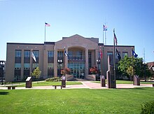
Portage County Courthouse
|
||
|
||
 Location in the U.S. state of Ohio |
||
 Ohio's location in the U.S. |
||
| Founded | June 7, 1808 | |
| Named for | the portage between the Cuyahoga and Tuscarawas Rivers | |
| Seat | Ravenna | |
| Largest city | Kent | |
| Area | ||
| • Total | 504 sq mi (1,305 km2) | |
| • Land | 487 sq mi (1,261 km2) | |
| • Water | 17 sq mi (44 km2), 3.3% | |
| Population | ||
| • (2010) | 161,419 | |
| • Density | 331/sq mi (128/km²) | |
| Congressional districts | 13th, 14th, 16th | |
| Time zone | Eastern: UTC-5/-4 | |
| Website | www |
|
Portage County is a county located in the U.S. state of Ohio. As of the 2010 census, the population was 161,419. Its county seat is Ravenna. The county was created in 1807 and organized in 1808 and is named for the portage between the Cuyahoga and Tuscarawas Rivers.
Portage County is part of the Akron Metropolitan Statistical Area, which is also included in the Cleveland–Akron–Canton Combined Statistical Area.
The name "Portage" comes from an old Native American path called "Portage Path", which ran between the Cuyahoga and Tuscarawas rivers, where travelers portaged their canoes. The location of the trail today is within the boundaries of neighboring Summit County.
After the discovery of the New World, the land that became Portage County was originally part of the French colony of Canada (New France), which was ceded in 1763 to Great Britain and renamed the Province of Quebec. In the late 18th century the land became part of the Connecticut Western Reserve in the Northwest Territory, then was purchased by the Connecticut Land Company in 1795.
...
Wikipedia

