Rich Hole Wilderness
| Rich Hole Wilderness | |
| Part of George Washington National Forest | |
| Wilderness Area | |
| Country | United States |
|---|---|
| State | Virginia |
| County | Alleghany, Rockbridge |
| Elevation | 3,400 ft (1,036.3 m) |
| Coordinates | 37°52′17″N 79°38′18″W / 37.87139°N 79.63833°WCoordinates: 37°52′17″N 79°38′18″W / 37.87139°N 79.63833°W |
| Highest point | Brushy Mountain |
| - elevation | 3,500 ft (1,066.8 m) |
| Lowest point | |
| - elevation | 1,500 ft (457.2 m) |
| Area | 6,450 acres (2,610.2 ha) |
| Established | 1988 |
| Management | George Washington and Jefferson National Forests |
| Owner | USDA Forest Service |
| IUCN category | Ib - Wilderness Area |
| Nearest city | Lexington, Virginia |
| Website: George Washington and Jefferson National Forests – Rich Hole Wilderness Area | |
Rich Hole Wilderness is a designated wilderness area in the James River Ranger District of the George Washington and Jefferson National Forests of Virginia in the United States. The wilderness area was established in 1988 and comprises 6,450 acres (26.1 km2). It is administered by the US Forest Service.
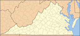
Rich Hole Wilderness is located 16 miles (26 km) west of Lexington, Virginia, just off of Interstate 64. Rich Hole Wilderness ranges in elevation from 1,500 feet (457 m) to 3,500 feet (1,067 m). The wilderness is named after the drainage "holes" in Brushy Mountain. The Rich Hole Wilderness drainages, the North Branch of Simpson Creek and Alum Creek, are tributaries of the Calfpasture River, which feeds into the James River and the Chesapeake Bay.
The Virginia Wilderness Act of 1984 (P.L. 98-586) designated four study areas including the Rich Hole Wilderness, and directed a two-year study by EPA and the State of Virginia on the effects of a proposed development on air quality of the four areas. Under the Clean Air Act, newly designated wilderness areas are only automatically reclassified as PSD Class I if they expand existing mandatory Class I areas. The members of the Virginia congressional delegation were apparently satisfied with the conclusions, and subsequently designated these areas (along with two other areas) as wilderness in 1988 (P.L. 100-326).
The Forest Service in 2009 was working on a revision to its Forest Plan for the George Washington National Forest that proposed adding wilderness acreage to the Rich Hole Wilderness western boundary. The Forest Service stated that "[t]he Rich Hole Addition offers the opportunity to expand the acreage of a small existing Wilderness and almost connect the Rich Hole Wilderness to the Rough Mountain Wilderness."
Rich Hole Wilderness supports old growth white ash and northern red oak along a stream within its boundaries.
...
Wikipedia

