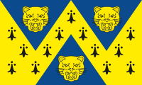
Salop
| Shropshire | |||
|---|---|---|---|
| County | |||
|
|||
| Motto: "Floreat Salopia" ("May Shropshire flourish") | |||
 Shropshire in England |
|||
| Coordinates: 52°37′N 2°43′W / 52.617°N 2.717°WCoordinates: 52°37′N 2°43′W / 52.617°N 2.717°W | |||
| Sovereign state | United Kingdom | ||
| Country | England | ||
| Region | West Midlands | ||
| Established | Ancient | ||
| Ceremonial county | |||
| Lord Lieutenant | Algernon Eustace Heber-Percy | ||
| High Sheriff | Diana Flint | ||
| Area | 3,487 km2 (1,346 sq mi) | ||
| • Ranked | 13th of 48 | ||
| Population (mid-2015 est.) | 482,500 | ||
| • Ranked | 42nd of 48 | ||
| Density | 138/km2 (360/sq mi) | ||
| Unitary authority | |||
| Council | Shropshire Council | ||
| Executive | Conservative | ||
| Admin HQ | Shrewsbury | ||
| Area | 3,197 km2 (1,234 sq mi) | ||
| • Ranked | 4th of 326 | ||
| Population | 311,400 | ||
| • Ranked | 33rd of 326 | ||
| Density | 97/km2 (250/sq mi) | ||
| ISO 3166-2 | GB-SHR | ||
| ONS code | 00GG | ||
| GSS code | E06000051 | ||
| NUTS | UKG22 | ||
| Website | www |
||
 Districts of Shropshire Unitary |
|||
| Districts |
|
||
| Members of Parliament | List of MPs | ||
| Police | West Mercia Police | ||
| Time zone | GMT (UTC) | ||
| • Summer (DST) | BST (UTC+1) | ||
Shropshire (/ˈʃrɒpʃər/ or /ˈʃrɒpʃɪər/; alternatively Salop; abbreviated, in print only, Shrops; demonym Salopian /səˈloʊpjən/) is a county in the West Midlands of England, bordering Powys and Wrexham in Wales to the west and north-west, Cheshire to the north, Staffordshire to the east, Worcestershire to the south-east and Herefordshire to the south. Shropshire Council was created in 2009, a unitary authority taking over from the previous county council and five district councils. The borough of Telford and Wrekin has been a separate unitary authority since 1998 but continues to be included in the ceremonial county.
...
Wikipedia

