Gotthard pass
| Gotthard Pass | |
|---|---|
|
Italian: Passo del San Gottardo German: Gotthardpass |
|

Gotthard's Hospice and Museum
|
|
| Elevation | 2,106 m (6,909 ft) |
| Traversed by | 2 |
| Location |
Canton of Ticino, Switzerland (close to canton of Uri) |
| Range | Lepontine Alps |
| Coordinates | 46°33′22.5″N 8°34′04″E / 46.556250°N 8.56778°ECoordinates: 46°33′22.5″N 8°34′04″E / 46.556250°N 8.56778°E |
| Topo map | Swiss Federal Office of Topography swisstopo |
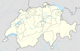
| Location in Switzerland | |
The Gotthard Pass or St Gotthard Pass (Italian: Passo del San Gottardo, German: Gotthardpass at 2,106 m (6,909 ft)) is a mountain pass in the Alps, connecting northern to southern Switzerland. The pass lies between Airolo in the Italian-speaking canton of Ticino, and Andermatt in the German-speaking canton of Uri, and connects further Bellinzona to Lucerne, Basel, and Zurich. The region of the Gotthard Pass is an important north-south axis in Europe and is crossed by three major traffic tunnels, each being the world's longest at the time of their construction: the Gotthard Rail Tunnel (1882), the Gotthard Road Tunnel (1980) and the Gotthard Base Tunnel (2016).
Though the pass was locally known in antiquity, it was not generally used until the early 13th century because travel involved fording the turbulent Reuss, swollen with snowmelt during the early summer, in the narrow steep-sided Schöllenen Gorge (German: Schöllenenschlucht), below Andermatt. As early as 1236, Gotthard Pass was dedicated to the Roman Catholic Saint Gotthard of Hildesheim.
The Gotthard Pass connects the cantons of Uri (north) and Ticino (south). The pass itself is located within the latter canton, about 2 km south of the border with Uri, between the massifs of Pizzo Lucendro (west) and Pizzo Centrale (east). The pass lies on the most important route between the southern canton of Ticino and central Switzerland as well as most of the northern part of the country. It is the most direct link between Zürich and Lugano and also between some regions of Germany and Italy. The nearest towns are Hospental (7 km north) near Andermatt and Airolo (4 km south), respectively in the valleys of Urseren and Leventina. The region of Andermatt lies at the foot of the Furka and Oberalp passes connecting the Rhone and Rhine valleys thus making the Gotthard area a strategic place for transports and military (the Swiss Réduit for instance).
...
Wikipedia

